
 Walking is a great way to experience the scenic variety and beauty of the Kiewa Valley and the unique Bogong High Plains. The walks suggested below vary from a short half to three quarter hour stroll, up to a 4 – 5 hour trek. Some are flat and easy, while others have some steep sections and require a reasonable level of fitness. Any effort you put in will be rewarded by the beauty of the bush and the excellent scenery. Remember to choose a walk within your group’s experience and limitations. If you are contemplating a walk in the high country, we suggest you obtain a map or guide book from one of the local outlets, including the Visitor’s Centre.
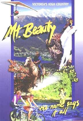
1. Mt. Beauty Pondage Walk/Ride
Duration: Approximately 45 minutes
Terrain: Flat
Grade: Easy
The ‘Talking Trees’ audio tapes are available at the Mt Beauty Information Centre to assist you in enjoying the sights of this beautiful walk/ride.
This is an ideal jogging track or a pleasant walk around the Pondage. Starting from the Lakeside picnic and play ground area, walk north towards Embankment Drive and follow the obvious path around the pondage wall. Follow the track over the spillway to the rear of the Southern Hydro yards. Turn left cross over the Tail Race Channel and you will be behind the Secondary College. Walk along behind the Secondary College, the tennis Courts, and the Primary School, past the Oval and back to where you started.
2. Mt Beauty Gorge
Duration: Minimum 1 hour walk
Terrain: Hilly
Grade: Moderate
This track takes you to a gorge which is a stones throw from the centre of town. The track leads to a shady picnic/swimming spot.
Start from Mt. Beauty Hospital & walk up Chalet Road to the derelict Mt. Beauty Chalet. After the sealed road finishes follow the dirt track for about 100m, veer right at the Aqueduct Track signpost. This track descends down to the gorge. Enjoy magnificent views north up the Kiewa Valley, the tail race channel travels underneath via a huge pipe releasing all the hydro water into the pondage. The track finishes at the West Kiewa River. This is the site of a bridge which was washed away during floods many years ago. After enjoying this scenic pristine spot return via the same track
3. Mountain Creek Picnic Area Walks
(No bike access)
Further Information: A Parks Victoria Map and trail notes is available from local outlets
Duration: 4 walks ranging from 15 Mins to 1 Hr. Each
Terrain: Undulating
Grade: Easy
Walker’s Advisory: It is best to avoid the Mountain Creek area following rain, as the area is prone to leaches when damp.
This walk is along the flat area to the base of the track to Mt. Bogong. The walk to the summit of Mt. Bogong is described in walk No. 6. Drive out to the Mountain Creek picnic area at the end of Mountain Creek Road (turn off the Kiewa Valley Hwy At the Bogong Hotel, Tawonga and drive for about 10.5 Kms). A track marked ‘4WD only ‘ Starts at the eastern edge of the car park area. It is a delightful track just to stroll along, following Mountain Creek, and crossing it via numerous rustic wooden bridges. This is a beautiful, cool tree-ferned walk, ideal for a hot summer day. 2 kms up the track you find the start of the Staircase Spur walking track, one of the main access tracks to the summit of Mt Bogong, Victoria’s highest peak (1986m). Return via the same route, but if you feel like wandering further, you can. The track goes quite a long way around the base of Mt Bogong. There are numerous short walks in this area – there is a large sign at the picnic area describing them.
4. Vales Hill Walk (Usuitable for bikes)
Further Information: A specific map is available from Rocky Valley Outdoors.
Duration: Approximately 1-2 hours
Terrain: Quite steep in places. Requires moderate fitness level.
Grade: Moderate to steep
From the Kiewa Valley Highway turn into Vales Road (near Vic Parks office & Rocky Valley Outdoors & Bikes). Walk up Vales Road and veer left onto a dirt track. See the map that is on the edge of the track. The track is well defined.
5. Mt Beauty Circuit
Duration: Approximately 4 -5 hours
Terrain: Quite steep in places. For a moderate fitness level.
Grade: Moderate to steep
Walker’s Advisory: It is advisable to carry a day pack and some food and water on this trip. Sturdy boots are recommended.
An interesting loop walk from the Mt. Beauty pondage to the actual hill of Mt. Beauty (685 m) can be undertaken by walking the following route. Walk North from the pondage area to Damms Rd and turn left, then proceed 250 m and turn right to follow Rock Pools Road to the East Kiewa River. Follow the upper track skirting the horse paddock, then proceed along the steep track up past the reservoir, then take the vehicle track up to the Bogong High Pains Rd. (the main road to Falls Creek). Cross the road at this point, but watch out for vehicles because this road tends to be busy during the holiday season. Proceed up an obvious foot track along the clearly defined ridge line. This part of the walk follows a traditional stock route used by local cattlemen to take their stock to the high country for summer. The track meanders for approximately 1km then it meets a vehicle track down to the back of the derelict Mt. Beauty Chalet. From the Chalet, cross the highway and return through town to your starting point, a return trip of about 6kms.
6. Survey Track
Duration: Approximately 2 hours
Terrain: A steady climb with some flat sections. A little steeper towards the end.
Grade: Easy to moderate
This track is a shared walking track and mountain bike track. Beware of bikes. It commences adjacent to the Mt. Beauty Golf Course Club House, Tawonga Crescent. You will see a sign post at the start just below the Falls Creek Road. This track is single file for most of the way and parallels the road. The track meanders upwards, through dry forest areas it reaches Cranky Charlie on the Falls Creek road. You will cross a couple of fire trails … look for the restart of the track on the other side. On reaching Cranky Charlie, you can either return the way you came, or walk down the road.
7. Climb Mt Bogong
Further Information: A Parks Victoria Map and trail notes is available from local outlets
Duration: Approximately 6 – 7 hours
Terrain: Rough in places. Sturdy boots required.
Grade: Steep. For the fit and well prepared.
Walker’s Advisory: The return climb up Victorias highest mountain is quite possible in a day. But, there are some things you must do before you go:
1. Complete a “Trip Intention” form and leave it with either the Visitors’ Centre, the National Parks Service Rangers or the Police.
2. Take warm clothing (even in the middle of Summer), water and food to allow for a comfortable overnight stay if the weather turns bad. The conditions we experience at the bottom of the mountain can be totally different to those at the top. Alpine conditions can change in well under the time it takes to walk to the summit.
3. If tackling this trip as a novice family ask advice from the Visitors’ Centre, the National Parks Service Rangers or the Police. Ask them to brief you on what to expect.
4. Always carry a First Aid Kit, a topographic map and, if possible, a cellular phone for emergencies. Remember … even experienced bushwalkers have perished on Bogong. If in doubt about conditions ask the Visitors’ Centre for a weather update. The Bogong Alpine Area Map is available at the Visitors’ Centre and a number of other local outlets.
The trip up Mt. Bogong starts from the Mountain Creek Picnic ground, 10.5 Kms out along Mountain Creek Road from the Bogong Hotel on the Kiewa Valley Hwy. Walkers should then follow the signs along the 4WD track, over the many stream crossings, to the start of the Staircase Spur walking track (there are other ways to the summit, but this is the recommended route). Turn right here and start your ascent of the mountain. Down low, it is not unusual to encounter snakes on the track, so be careful.. This track was formerly known as Maddison’s Track as it is the path once used by the Maddison family to drive their cattle on to the high plains. It is very well used and well marked, so negotiating it is not difficult.
At about the half way point you will come across Bivouac Hut. This is a relatively new construction replacing the original hut, destroyed by fire in the late 1970’s. As you climb away from Bivouac Hut, the timber starts to thin a little, and the ridge line you are climbing becomes more pronounced. Shortly after leaving the comfort of the wooded areas, the magnificent scenery becomes apparent. On the track, above the snowline, you will encounter a cairn known as the Gadsden Memorial. This commemorates the unfortunate death of 3 walkers who perished at that spot in a blizzard.
A little further up the track are ruins of the old Summit Hut. This Hut was destroyed some years ago in suspicious circumstances. From here the levelling out of the roof of Victoria becomes apparent. The Summit Cairn is a little to the west, and on reaching this point, you are now standing on the top of Victoria. If the weather is good, then for another hours effort, a walk to the west will take you to West Peak overlooking the Kiewa Valley and Mt. Beauty township.
The return trip is back by the same route, or by the Eskdale Spur. This is reached by retracing your steps ’til you reach Eskdale Point at Pole 1272, where the track steeply descends the spur. Michell Hut is an excellent refuge in bad weather. You will eventually meet up with a fire trail at Camp Creek Gap. Follow this north, then take the left-hand branch back along Mountain Creek, past the start of the Staircase to the picnic area.
Many experienced walkers prefer to climb the Staircase Spur and to descend the Eskdale Spur.
8. Bogong Village (2 tracks)
Track A: Lake Guy Walk
Duration: Approximately 1 – 1.5 hours
Terrain: Undulating, some steps to negotiate
Grade: Easy
Drive to Bogong Village, approximately 15 Kms along the Bogong High Plains Rd towards Falls Creek. Park in the car-park just below the Bogong Store. The track around Lake Guy starts 150m North West of the car-park (it is well signposted). There are some magnificent examples of tree ferns just below the dam wall. Continue through the dam wall and follow the walking track to “the Junction” where the Pretty Valley and Rocky Valley Branches of the East Kiewa River converge in spectacular style. Cross over the white bridge at the southern end of the car-park and return via the vehicle track or by the lower walking track.
Track B: Rocky Valley Gorge Walk
Duration: 1 hour
Terrain: A little climbing, some sections may be difficult for the less agile
Grade: Moderate
Starts from the lower picnic area (“the Junction”) at Bogong Village. The track follows the rocky valley branch of the East-Kiewa River up to a spectacular rocky gorge. Return the same way you came. There are some awkward spots.